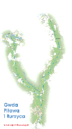
The largest right tributary of the Noteć, the Gwda, once called the Głda, flows through the Bytowskie Lakeland, the Charzykowska Plain, the Gwda Valley, and the Middle Noteć Valley. The river begins its course as the Bielska Struga at an altitude of 157 m above sea level near the village of Białe, southwest of Biały Bór. Lower down, it flows through Lake Studnica, where kayakers usually begin their water adventure in Dresden.
The next sections of the trail provide a huge variety of landscape and nature. The Gwda passes Lake Wierzchowo, and then, among fields, trees and meadows of the sand plain, absorbs more smaller and larger lakes. The largest on the trail - Lake Wielimie, 7 km long and not very deep - can be a big obstacle for kayakers, especially when the winds are blowing, which create high waves on the water. The middle section of the proglacial valley is cut by tributaries that are attractive kayaking routes - these are Dołga, Czernica, Płytnica, Rurzyca, Piława with Dobrzyca and Głomia. The forest zone accompanying the river is called Puszcza nad Gwdą. In this large pine forest live fine game, including wild boars, roe deer and deer. Beavers mark their presence with numerous fallen trees. There are also capercaillies, cranes and herons, and rare fish such as huchens, trouts and graylings.
After the river was dammed with earthen dams, dam lakes were created, creating retention reservoirs in Podgaje, Jastrowie, Ptusza and Dobrzyca. The trail also passes many smaller dams, on which small hydroelectric power plants are located. They make this picturesque and attractive trail a bit arduous, because the water standing in front of the dams forces greater effort and carrying kayaks. However, the difficulties are compensated by the charming views, fanciful shapes of the shoreline, numerous branches or forested hills rising above the water. Overcoming the long and numerous rapids at the gorge behind Płytnica is a real adventure. Military enthusiasts will probably be interested in the Pomeranian Wall fortification system running along the river. Lower down, the Gwda flows through the populated, once provincial Piła, to end its hard-working course in Ujście, joining the Noteć. The trail does not require much kayaking experience, although it is more conducive to those somewhat familiar with the kayaking craft. Thirteen permanent portages could be divided into several rivers. The right tributary of the Gwda - Piłowa, a real miracle of nature, a variable and extremely charming river, flows through the South Pomeranian Lake District.
In its upper reaches, its basin includes the beautiful landscape areas of the Drawsko Lake District with the Drawsko Landscape Park. The area is diversified by numerous, picturesquely connected lakes, immersed in the Drawsko Forest, which tightly fills the space. The park was established in 1979 in the central part of the Drawsko Lake District, in the communes of Barwice, Borne Sulinowo, Czaplinek, Ostrowice, Połczyn Zdrój and Złocieniec. It covers an area of 41,430 ha. The post-glacial landscape formed during the last glaciation, known as the Baltic Glaciation, is subject to special protection. The terminal moraine hills covered with beech and pine forest are separated by lake channels. The richness and diversity of flora and fauna is evidenced by 7 reserves and 300 natural monuments. Of the 695 plant species, the most valuable are: monkshood, daphne, sundew, clubmoss, Pomeranian honeysuckle and relicts: lake lobelia and yellow water lily. Only in a few places, above the middle section of the course, on the Wałecka Plain, there are vast treeless clearings. Here, before World War 11, the Germans built a strip of military fortifications called the Pomeranian Wall, stretching along the river.
The lower section of the river is treeless, has high, interesting banks. The current is diversified by underwater boulders and numerous rapids. Despite these obstacles, the Piława is a safe river and can be recommended to swimming families. In Dobrzyca, the waters of the Piława are absorbed by the Gwda, creating together the barrier Lake Dobrzyckie. The largest tributary of the Piława - the Dobrzyca is also a kayaking trail, and through Piławka it is a connection with the Wałecka Loop.


