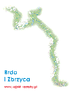
BRDA
It is considered one of the most beautiful waterways in Poland and Europe. It has 43 direct tributaries and passes 19 lakes. It flows out of Lake Smołowe, in the central part of the Bytów Lakeland, a few kilometers east of Miastko, and ends its course in Bydgoszcz, where it flows into the Vistula in the Brdyuście district. Kayaking is possible on the Brda River for 233 km, starting from Lake Pietrzykowskie Duże, near Miastko, although the river is rarely used in its initial section. The extremely diverse, winding course of the waterway, extensive forests, picturesque lakes, primeval nature and numerous side trails have been attracting many water tourists to the Brda for years. The upper course of the Brda is a virgin stream flowing through a compact, sparsely populated forest complex. This section of the river, although very picturesque, is quite troublesome for kayakers. At low water levels, there may be shallows, which means that the kayak often has to be towed. In addition, numerous beavers effectively "help" in felling trees, blocking the river with them. In this area, kayak traffic is therefore much smaller, and the campsites are more spartan than in the middle and lower sections of the river. The gem is the "Przyton" reserve, through which the river stubbornly squeezes, overcoming numerous obstacles lying in the riverbed. This upper gorge section of the Brda River makes a great impression on water sports enthusiasts.
From Nowa Brda, the flow is almost without obstacles, and the riverbed gradually widens. At the northern ends of the Krajeńskie Lakeland, you have to sail through several lakes: Szczytno, Szczycienko, Krepsko and Końskie. Overcoming them is a real slog for kayakers.
In its middle section, the Brda initially flows eastwards through a series of beautiful channel lakes of the Charzykowski Plain - this is the beginning of the Tuchola Forest with the Zaborski Landscape Park and the Tuchola Forest National Park, which is part of it. The interesting course of the river, numerous lakes, diverse landscape and clean water are a magnet that attracts tourists, especially water sports enthusiasts. The Zbrzyca River, accessible for kayaks, flows into Lake Witoczno from the north, carrying water from over twenty beautiful Kashubian lakes. Below Męcikał, already in the Tuchola Forest, kayakers will encounter only one obstacle. It is the dam in Mylof, which directs part of the river's waters to the Great Brda Canal - an impressive hydrotechnical structure from the mid-19th century. This canal, which runs parallel to the Brda, in places along aqueducts, over several of its tributaries, can be an alternative kayaking route for those rafting down the Brda.
The Tuchola Landscape Park and the reserve "Dolina Rzeki Brdy" are the main attractions of the river's gorge. The dammed Brda in its lower reaches creates a picturesque, 30-kilometer-long backwater of Lake Koronowskie, the most beautiful and largest on the entire river route. This lake is characterized by an extremely diversified shoreline with numerous deep bays and is surrounded by forests on almost all sides. The Bydgoszcz section of the river is equally attractive. Bydgoszcz lies on the Brda and Vistula, the old and new Bydgoszcz Canal. There is a slalom track for whitewater kayaking, located in the city centre, in the shadow of the Gothic parish church, between the historic locks of the Mill Island. In Brdyuście - the place where the Brda flows into the Vistula - a regatta track and the last lock on the river were built. The final, navigable section of the Brda is a part of the waterway connecting the Vistula with the Noteć via the Bydgoszcz Canal. The trip can therefore be extended by continuing down the Vistula or Noteć rivers, or via the Upper Notecki Canal, Lake Gopło and the Silesian Canal - along the Warta river.
The Brda is an easy trail, accessible for beginners, a bit troublesome only in the upper reaches, although there are places, especially in the gorge section, where unruly tourists can be abused by the river and taught respect (more information on kayaking techniques, terminology, etc. in the book Kajaki od A do Z. Poradnik i porada). Of course, it is good to read (observe) the water carefully. It takes at least 10 days to complete the entire water route, but due to the possibility of turning off from the main stream, it is worth devoting even 2-3 weeks to the rafting. The Brda is one of the best developed tourist kayaking routes in Poland, and thanks to the good system of marking the river, kayakers feel safe and even without a map, they have a perfect sense of direction.
ZBRZYCA
This is the right tributary of the Brda River, flowing through the Charzykow Plain in the area of the Zaborski Landscape Park. Kayakers are very keen to visit this most beautiful of the Brda tributaries due to its picturesque and varied rafting route, which leads through forests almost along its entire length. The water trail - easy, although troublesome in the upper reaches - has been marked on the most frequently visited section from Leśno (Młosin) to Swornegacie. The Upper Zbrzyca - a narrow, rebellious river - flows through several lakes: Wielkie Sarnowicze, Somińskie, Kruszyńskie, Parzyn. Kayakers will have to portage their kayaks several times at mills, weirs and sawmills. The river and its surroundings become more beautiful with every kilometer. The terrain is undulating, covered with beautiful forests. In the middle section, the river gradually slows down, deepens and again passes several beautiful, forest lakes, connected in a picturesque chain. The lakes that appear one after another are Milachowo with high, forested shores, then Laska, Księże, Parszczenica, and Śluza. They are all charming, but the most beautiful is the last one - quiet and deserted. The most important tributaries of the river, which are also kayaking routes, are Młosienica (Młosina), Kulawa and Kłoniecznica. Zbrzyca is also a bridge between the Brda and the Wda. Having reached Lake Sarnowicze Małe upstream, you can transfer your kayaks to Lake Wieckie [2.5 km] - this is the beginning of the Wda River kayak trail.
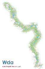
WDA
The beautiful lowland-forest and meandering Wda among forests is a very picturesque and attractive landscape trail. It has numerous bays, and its sandy-rocky bottom is overgrown with seaweed. Also called Czarna Woda, it begins its course on the Charzykowska Plain, flowing out of Lake Krążno. In large meanders and arcs it leads through the Tuchola Forest. Below Lake Wdzydze, the Wda Canal branches off. Below Tleń, the Wda flows into the Świecie Upland and flows into the Vistula in Świecie, in the Fordon Valley, at an altitude of about 23 m above sea level.
In the upper section the river can be capricious, and at the beginning of its course it is almost suitable for rafting. Although at times troublesome, at other times it becomes a feisty river with a fast current. In this area it flows through numerous lakes, and in addition there are over 350 smaller or larger lakes not far from it. In its middle course the Wda becomes a fast, wild river with numerous rapids, cutting through the Tuchola Forest. Peace and quiet reign here, because it is a great area.
In its lower course it passes the dam lakes in front of the power plants, and behind them it becomes fast and untamed. Between the two twin rivers: the Brda and the Wda, stretches the Tuchola Forest, the second largest forest complex in Poland, located between Chojnice and Tuchola in the south and Kościerzyna and Starogard Gdański in the north. There are numerous ribbon lakes here with a total area of 120 thousand ha. There are preserved refuges for rare bird species. e.g.
On the slopes of river valleys, mainly the Wda, very valuable and rare multi-species deciduous forests with a diverse flora of lichens have developed, and in the valley bottoms there are alluvial forests (forests with rich undergrowth and ground cover) and alder forests (swamp forests with a predominance of black alder). A peculiarity is the occurrence of wild service tree in the "Brzęki" reserve named after Zygmunt Czubiński in Szczerków. Among the rare and protected plants in the Wda Landscape Park are, among others: clubmoss, flattened clubmoss and juniper clubmoss, sundews, broadleaf and spotted orchids, lesser butterfly-orchid, broadleaf helleborine, common twayblade, wild ginger and bearberry. Fauna peculiarities include cranes, goldeneyes, goosanders, marsh harriers, ruffs, kingfishers, brown trouts, European adders, spotted salamanders, tree frogs and great crested newts. Covering this less developed water artery of the Tuchola Forest and Kociewie by kayak will not pose any problems even for less skilled water sportsmen, although Lake Wdzydzkie can be a dangerous obstacle in bad weather.
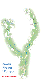
GWDA
The largest right tributary of the Noteć, the Gwda, once called the Głda, flows through the Bytowskie Lakeland, the Charzykowska Plain, the Gwda Valley, and the Middle Noteć Valley. The river begins its course as the Bielska Struga at an altitude of 157 m above sea level near the village of Białe, southwest of Biały Bór. Lower down, it flows through Lake Studnica, where kayakers usually begin their water adventure in Dresden.
The next sections of the trail provide a huge variety of landscape and nature. The Gwda passes Lake Wierzchowo, and then, among fields, trees and meadows of the sandur plain, absorbs more smaller and larger lakes. The largest on the trail - Lake Wielimie, 7 km long and not very deep - can be a big obstacle for kayakers, especially when the winds are blowing, which create high waves on the water. The middle section of the proglacial valley is cut by tributaries that are attractive kayaking routes - these are Dołga, Czernica, Płytnica, Rurzyca, Piława with Dobrzyca and Głomia. The forest zone accompanying the river is called Puszcza nad Gwdą. In this large pine forest live fine game, including wild boars, roe deer and deer. Beavers mark their presence with numerous fallen trees. There are also capercaillies, cranes and herons, and rare fish such as huchens, trouts and graylings.
After the river was dammed with earthen dams, dam lakes were created, creating retention reservoirs in Podgaje, Jastrowie, Ptusza and Dobrzyca. The trail also passes many smaller dams, on which small hydroelectric power plants are located. They make this picturesque and attractive trail a bit arduous, because the water standing in front of the dams forces greater effort and carrying kayaks. However, the difficulties are compensated by the charming views, fanciful shapes of the shoreline, numerous branches or forested hills rising above the water. Overcoming the long and numerous rapids at the gorge behind Płytnica is a real adventure. Military enthusiasts will probably be interested in the Pomeranian Wall fortification system running along the river. Lower down, the Gwda flows through the populated, once provincial Piła, to end its hard-working course in Ujście, joining the Noteć. The trail does not require much kayaking experience, although it is more conducive to those somewhat familiar with the kayaking craft. Thirteen permanent portages could be divided into several rivers. The right tributary of the Gwda - Piłowa, a real miracle of nature, a variable and extremely charming river, flows through the South Pomeranian Lake District.
In its upper reaches, its basin includes the beautiful landscape areas of the Drawsko Lake District with the Drawsko Landscape Park. The area is diversified by numerous, picturesquely connected lakes, immersed in the Drawsko Forest, which tightly fills the space. The park was established in 1979 in the central part of the Drawsko Lake District, in the communes of Barwice, Borne Sulinowo, Czaplinek, Ostrowice, Połczyn Zdrój and Złocieniec. It covers an area of 41,430 ha. The post-glacial landscape formed during the last glaciation, known as the Baltic Glaciation, is subject to special protection. The terminal moraine hills covered with beech and pine forest are separated by lake channels. The richness and diversity of flora and fauna is evidenced by 7 reserves and 300 natural monuments. Of the 695 plant species, the most valuable are: monkshood, daphne, sundew, clubmoss, Pomeranian honeysuckle and relicts: lake lobelia and yellow water lily. Only in a few places, above the middle section of the course, on the Wałecka Plain, there are vast treeless clearings. Here, before World War 11, the Germans built a strip of military fortifications along the river, called the Pomeranian Wall.
The lower section of the river is treeless, has high, interesting banks. The current is diversified by underwater boulders and numerous rapids. Despite these obstacles, the Piława is a safe river and can be recommended to swimming families. In Dobrzyca, the waters of the Piława are absorbed by the Gwda, creating together the barrier Lake Dobrzyckie. The largest tributary of the Piława - the Dobrzyca is also a kayaking trail, and through Piławka it is a connection with the Wałecka Loop.
SLUPIA
The Słupia flows down at an altitude of about 178 m above sea level from peat bogs near Siera-owska Huta in the Kashubian Lake District, and ends its course, flowing into the Baltic Sea in Ustka. This interesting kayaking trail has a great advantage: the 62-kilometer section from Sulęczyno to Gałęźnia Mała is listed in the GOK-PTTK regulations as a mountain kayaking trail. Another attraction are the hydrotechnical historic structures of several power plants from the years 898-1926 and the adits, canals, earth dams and siphons associated with them. This makes it necessary to carry or even transport the kayaks sometimes over considerable distances. However, these inconveniences are compensated by the possibility of viewing the mergetic system, unique in Europe.
In its upper reaches, the Słupia flows through numerous lakes. In the middle reaches, as a result of water damming, the Konradowo and Krzynia flood reservoirs were created. The river changes its course several times, making wide arcs. The width and depth of the riverbed also change. In its lower reaches, the bottom is rocky, with boulders, rapids, and shallows. In short sections, the river has a gorge character. Particularly interesting are the sections within the Bytowskie Lake District and the 'olanowska Upland between the Zukowskie and Głębokie lakes, where the Słupia is a wild, forest river. The more interesting ones include the section with the long and winding Konradowo reservoir and the Słupsk Plain, where the river undercuts the western edges of the Damnicka Upland. Below Słupsk, a range of hills called the Włynkowskie Mountains appears.
A significant part of the rafting route leads through the protected forest areas of the Słupia Valley Landscape Park. This largest of the 9 landscape parks in the Pomeranian province was established in 1981. Together with the buffer zone, it covers 83,170 ha. It covers the area of the middle course of the river and its catchment area from Oszyca to the Krępa-Łosino road. It is a valley-type park. Forests, most often pine forests, cover 72%. Peat bogs are among the most interesting plant formations, and among them, particularly valuable raised bogs. An important element of the landscape are lobelia lakes overgrown with relict plants. The number of vascular plants in the park amounts to 748 species, and many of them are protected, valuable, rare and endangered species. Of note is the nesting of goldeneye, hen harrier, red kite, white-tailed eagle, lesser spotted eagle and eagle owl - birds that are endangered and entered in the "Polish Red Data Book of Animals". Due to the diversity and richness of avifauna, the park area has been recognized as one of 118 bird sanctuaries in Poland.
When sailing along this lively, dynamic and landscape-changing artery, it is important to remember that camping is only allowed in the park in six marinas prepared especially for kayakers. These places can be an excellent base for visiting interesting and attractive technical monuments - hydroelectric power plants or natural curiosities. The park management also asks that the number of trips be limited in June and early July due to the breeding season of rare species.
SHELL
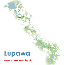
Łupawa is considered one of the most difficult kayaking routes in Po-norze. The river first flows through the interesting landscape of Lake Jasień, the largest in the Słupia Valley Landscape Park, then as a mountain stream through a deeply cut valley, breaks through moraine ranges, to disappear in the vast and shallow Lake Gardno, which it reaches by a flat coastal plain. Already in the Słowiński National Park, the Łupawa-Łebsko and Łebsko-Gardno canals connect the adjacent vast water areas. In the summer and fishing village of Rowy, the Baltic Sea absorbs the unruly, slightly salty Łupawa oxen, which are already in Gardno. The river, flowing quickly towards the sea, flows through picturesque forests and surroundings. In the upper and middle reaches, the trail flows "through a valley of a gorge character, cutting through the moraine ranges.
For an adventure with Łupawa you need to be well prepared, because although this trail is not very long, the theoretically assumed 4-6 days of hiking will not be enough for everyone. It is better to paddle this difficult, strenuous trail, especially on the gorge sections, without luggage, in single-person kayaks, additionally equipped with sprays. Tourist doubles will also cope, but it will require greater effort from their crews, and luggage must be carefully protected from getting wet, because dangers lurk at every step.
The above texts were developed on the basis of "Guides for kayakers" by Zbigniew Galiński


